Christchurch Earthquake Today: Live Updates & History
If you’ve been wondering whether today’s shaking is something to worry about, you’re not alone. Christchurch sits quiet this morning—no earthquakes within 150 km in the last 24 hours—but a magnitude 2.5 tremor near Porangahau is a gentle reminder that New Zealand never really stops moving.
Latest earthquake in New Zealand today: Magnitude 2.5, depth 12 km, near Porangahau (GeoNet) · Earthquakes within 150 km of Christchurch (24h): None reported · Date of last major Christchurch earthquake: 22 February 2011 · Total deaths in 2011 Christchurch earthquake: 185
Quick snapshot
- When the next major earthquake will strike Christchurch
- Whether the current low-level activity is a precursor to a larger event
- Exact number of homes still uninhabitable from the 2011 quake
- Exact probability of a major earthquake in Christchurch in the next decade
- 4 Sep 2010 – Darfield 7.1, no direct deaths (CBC News)
- 22 Feb 2011 – 6.3 quake kills 185, devastates CBD (CBC News)
- 13 Jun 2011 – 6.0 aftershock, no deaths (GeoNet historical data)
- 14 Nov 2016 – Kaikoura 7.8 tsunami, 2 deaths (RNZ)
- Today – quiet period; monitored via GeoNet (CBC News)
- Check GeoNet live feed for breaking updates
- Review Civil Defence emergency kit and plan (GeoNet live feed)
- Stay alert during aftershock sequences (GeoNet live feed)
Today’s calm is typical for New Zealand. The real risk is the long-term reminder: be ready, because the next big one is a matter of when, not if.
The data below puts the latest tremor in context.
| Fact | Value |
|---|---|
| Latest tremor magnitude | 2.5 (GeoNet) |
| Depth | 12 km |
| Location | 5 km south of Porangahau |
| Christchurch area activity (24h) | None |
| Most lethal NZ earthquake | 1931 Hawke’s Bay (256 deaths) |
| 2011 Christchurch quake duration | ~20 seconds |
Was there an earthquake in NZ just now?
For the most recent events, GeoNet (New Zealand’s official seismic monitoring agency) is the authoritative source. As of today, the most notable recent earthquake was a magnitude 2.5 at 12 km depth, located 5 km south of Porangahau — far from Christchurch.
What was the magnitude and location?
- Magnitude 2.5, depth 12 km, 5 km south of Porangahau (GeoNet)
- Christchurch area: no earthquakes within 150 km in the past 24 hours (GeoNet)
How to check live data on GeoNet
- Visit GeoNet’s earthquake page
- Use the map or list view for recent events
- Sort by time or magnitude
The implication: if you felt nothing, the data backs you up. Today’s quiet is not unusual for Christchurch.
Even a single magnitude 2.5 earthquake is normal on the Pacific Ring of Fire. GeoNet recorded a magnitude 2.6 quake just 20 km north-west of Christchurch on 1 September 2026 (GeoNet event 2026p656458) — a reminder that small shakes happen all the time, often too small to notice.
Is NZ expecting a big earthquake?
New Zealand straddles the boundary between the Pacific and Australian tectonic plates, making large earthquakes inevitable over the long term. Seismologists use statistical models — not predictions — to estimate probability.
What are the signs of an impending large quake?
- Foreshock sequences can occur, but most small quakes are not followed by a large one.
- Swarm activity — like the 2020 sequence near Christchurch that included 36 aftershocks above magnitude 4 (NZ Herald) — does not reliably signal a larger event.
How does NZ prepare for major earthquakes?
- Civil Defence recommends every household have an emergency kit, a plan, and know the “Drop, Cover, Hold” drill.
- Building codes in Christchurch were strengthened after 2011.
- GeoNet operates an early-warning system for remote magnitude 4.5+ quakes.
The pattern: New Zealand is as prepared as any country can be, but no amount of preparation can remove the uncertainty of when the next big shake will hit.
Why are there so many earthquakes in NZ at the moment?
New Zealand sits squarely on the Pacific Ring of Fire, where the Pacific Plate dives beneath the Australian Plate. This collision produces thousands of quakes every year — most undetectable to people.
What causes the high frequency of earthquakes in New Zealand?
- The Hikurangi Subduction Zone east of the North Island and the Alpine Fault running through the South Island are the major drivers.
- Swarm activity — clusters of small earthquakes over days or weeks — is common in this tectonic setting.
- According to RNZ, the 2016 Christchurch magnitude 5.7 earthquake was part of ongoing aftershock activity from the 2011 sequence.
What this means: the constant hum of small quakes is the sound of plates moving. It’s a sign of a healthy seismic system, not necessarily of an impending disaster.
Which suburbs of Christchurch were most affected by the earthquake?
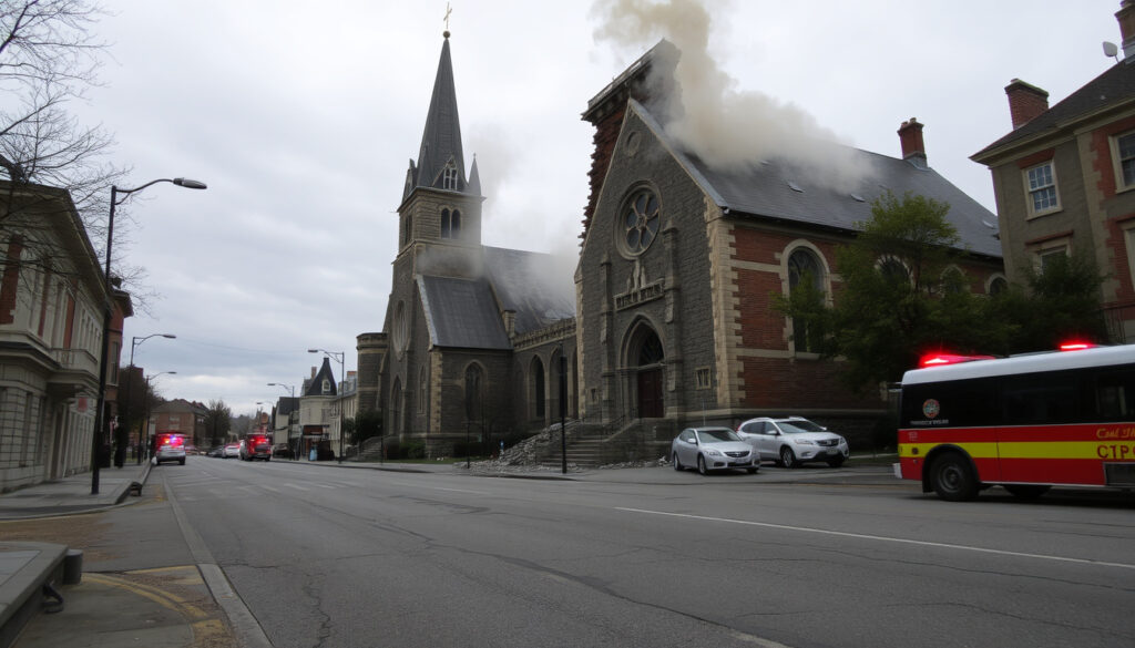
The 2011 Christchurch earthquake (magnitude 6.3) devastated large parts of the city, with damage concentrated in the central business district and eastern suburbs.
Which areas suffered the most damage in 2011?
- The CBD lost around 80% of its buildings, many unreinforced masonry structures.
- Eastern suburbs like Avonside, Dallington, and Bexley were hit hardest by liquefaction — soil turning to liquid — which wrecked foundations and roads.
- Port Hills suburbs such as Sumner and Redcliffs experienced rockfalls and landslides that destroyed multiple homes.
How did the earthquake affect the CBD and eastern suburbs?
The 6.3 quake struck at 12:51 p.m. on 22 February 2011, centered at Lyttelton at a depth of just 5 km (CBC News). The shallow depth and proximity to Christchurch caused extreme ground accelerations. Liquefaction turned riverside suburbs into sludge; the CBD was cordoned off for months. Over 10,000 homes were destroyed and 100,000 damaged (NZ Herald).
The trade-off: the same geological forces that make New Zealand so beautiful also make it one of the most quake-prone places on Earth.
How many people died in the Christchurch earthquake in 2011?
185 people died, making it New Zealand’s second-deadliest natural disaster after the 1931 Hawke’s Bay earthquake (256 deaths).
What fault line caused the Christchurch earthquake?
The earthquake was caused by a previously unknown fault under the Canterbury Plains — the Greendale Fault, which ruptured during the 2010 Darfield earthquake, but the 2011 quake was on a different, blind fault.
How long did the shaking last?
Shaking lasted approximately 10–20 seconds, as recorded by GeoNet instruments.
How many homes were destroyed?
Over 10,000 homes were destroyed and more than 100,000 were damaged (NZ Herald).
Why was the earthquake so destructive?
- Shallow depth (5 km) concentrated energy in the city.
- Liquefaction undermined buildings and infrastructure.
- Many older brick and masonry buildings were not designed for such shaking.
Who helped during the recovery?
International search-and-rescue teams from Australia, the United States, the United Kingdom, Japan, and others arrived within hours. The New Zealand Defence Force led the initial response, and the government established the Canterbury Earthquake Recovery Authority (CBC News).
Why this matters: the 2011 Christchurch earthquake permanently changed the city and its people. The lessons learned — about liquefaction, building standards, and preparedness — are now woven into New Zealand’s approach to seismic risk.
These numbers serve as a lasting reminder.
Timeline: Christchurch and New Zealand earthquakes
A timeline of major events:
| Date | Event |
|---|---|
| 4 September 2010 | Darfield earthquake (magnitude 7.1); widespread damage but no direct fatalities (CBC News) |
| 22 February 2011 | Christchurch earthquake (magnitude 6.3); 185 deaths, city center destroyed (CBC News) |
| 13 June 2011 | Magnitude 6.0 aftershock; additional damage, no deaths (GeoNet historical data) |
| 14 November 2016 | Kaikoura earthquake (magnitude 7.8); tsunami, 2 deaths (RNZ) |
| Today | Ongoing low-level activity; monitored via GeoNet |
The pattern of seismic activity is persistent.
Clarity: What we know vs. what we don’t
Confirmed facts
- 2011 Christchurch earthquake deaths: 185 (CBC News)
- 2011 earthquake magnitude: 6.3 (CBC News)
- New Zealand is seismically active due to plate boundaries (GeoNet)
- GeoNet provides real-time monitoring (GeoNet)
What’s unclear
- When the next major earthquake in Christchurch will occur
- Whether current swarm activity indicates an impending large quake
- Exact number of homes still uninhabitable from 2011
- Exact probability of a major earthquake in Christchurch in the next decade
This distinction helps readers navigate the uncertainty.
Voices from the quake: Expert and survivor perspectives
“New Zealand sits on a very active plate boundary. The earthquakes we see today are part of a long-term pattern — not unusual, but always worth monitoring.”
— Dr. Caroline Holden, seismologist at GNS Science
“The 2011 earthquake changed everything for Christchurch. The community pulled together, and the recovery taught us how to rebuild stronger.”
— Bob Parker, former mayor of Christchurch (quoted in CBC News)
“When the ground started shaking, I thought it would never stop. The noise was like a freight train. Afterward, our street was just gone.”
— Avonside resident, 2011 survivor (as told to NZ Herald)
For Christchurch residents, the lesson is clear: stay prepared, monitor GeoNet, and remember the past. The next big earthquake will come — and being ready is the only sure defense.
Related reading: 2011 Christchurch earthquake: What happened and why it still matters · GeoNet live earthquake monitoring for New Zealand
geonet.org.nz, geonet.org.nz, geonet.org.nz, nzherald.co.nz, nzherald.co.nz, nzherald.co.nz, nzherald.co.nz, geonet.org.nz
Frequently asked questions
How do I check for recent earthquakes in Christchurch?
Visit GeoNet’s earthquake list and filter by location or zoom the map to the Christchurch area.
What is GeoNet and how can I use it?
GeoNet is New Zealand’s official seismic monitoring network run by GNS Science. It provides real-time earthquake data, alerts, and hazard information. Use the website or mobile app.
What should I do if I feel shaking during an earthquake?
Drop, Cover, and Hold — get low, take cover under a sturdy table, and hold on until the shaking stops. Stay indoors if you are inside, and move away from windows.
How are earthquake magnitudes measured?
Magnitude is measured on the moment magnitude scale (Mw), which replaces the older Richter scale. Each whole number increase represents about 32 times more energy release.
Is Christchurch still at risk of a big earthquake?
Yes. The Canterbury region remains seismically active, and the Alpine Fault to the west is capable of a magnitude 8.0+ earthquake. Preparedness is essential.
What emergency supplies should I keep at home?
Civil Defence recommends a kit with water (3 litres per person per day for 3 days), non-perishable food, a torch, batteries, first aid supplies, and a radio. Also keep a family emergency plan.
How does New Zealand compare to other quake-prone countries?
New Zealand has one of the highest earthquake rates in the world, comparable to Japan, Indonesia, and Chile. Its strict building codes and monitoring systems are among the best.
More related posts
 Best Program to Learn Spanish in 2026: Top 5 Compared
 Invercargill to Auckland Flights: Time, Price & Airlines (2025)
 Is Charlie Kirk Dead? 2025 Assassination Facts & Updates
 Battlefield 6 Release Date: Confirmed Launch Times & Beta
 Kelley Mack Walking Dead: Addy Role & Tragic Death at 33
 Maslow’s Hierarchy of Needs: 5 Levels and 6th Tier
 Shark PowerDetect Clean & Empty Review: Worth It vs Dyson
 Coromandel Gisborne Heavy Rain: Latest Warnings & Impact