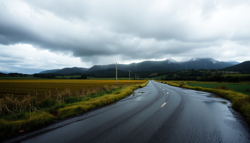
Coromandel Gisborne Heavy Rain: Latest Warnings & Impact
For anyone living on the Coromandel Peninsula or in the Gisborne region, the phrase “heavy rain warning” carries a familiar weight. The memory of Cyclone Gabrielle’s deluge in February 2023 is still fresh, and now, in late 2025, MetService has again issued red warnings for these same areas.
Rainiest NZ region (annual): West Coast, South Island ·
Cyclone Gabrielle peak rainfall: 488 mm at Hikuwai ·
MetService warning levels: Green, Yellow, Orange, Red
Quick snapshot
- Cyclone Gabrielle triggered five Red Rain Warnings, including Coromandel and Gisborne (MetService, New Zealand’s national weather service)
- The Pinnacles in Coromandel recorded 447 mm of rain (MetService)
- Gisborne’s red-warning area was forecast 300–400 mm, with peak intensities of 20–30 mm/h (Gisborne District Council, local civil defence authority)
- Hikuwai recorded the largest single accumulation at 488 mm (MetService)
- Exact rainfall totals for the December 2025 event are still being measured
- Long-term attribution between El Niño and climate change remains under study
- Whether the current event will exceed Cyclone Gabrielle’s local impacts is unknown
- Feb 2023 – Cyclone Gabrielle hits, multiple red warnings for rain and wind
- Dec 2025 – Active low brings red warnings again to Coromandel and northern Gisborne
- Stay tuned to MetService warnings for live updates
- Residents in red-warning zones should prepare for possible evacuations (MetService warnings)
Why is New Zealand getting so much rain?
New Zealand’s position in the South Pacific means it regularly intercepts moisture-laden air masses. During Cyclone Gabrielle, warm sea surface temperatures supercharged the system, leading to extreme rainfall rates. MetService recorded intensities of 20–30 mm per hour in the red-warning zones, enough to cause rapid flash flooding.
Climate patterns driving heavy rainfall
- La Niña tends to direct more tropical moisture toward New Zealand’s northeast, including Coromandel and Gisborne
- Orographic lift forces moist air up over mountain ranges, concentrating rainfall on windward slopes
The consequence: regions like Coromandel and Gisborne, already vulnerable to flooding, face repeated extreme rain events. As MetService’s summary notes, five red rain warnings were issued during Gabrielle alone, a clear signal of the intensity these systems can reach. The implication: these regions are caught in a cycle where warming oceans and shifting climate patterns amplify the damage.
How much rain did Gisborne get in Cyclone Gabrielle?
Gisborne bore the brunt of Gabrielle’s rainfall. MetService reports that the region’s stations recorded some of the highest totals in the country.
The table below shows the highest recorded rainfall totals across Gisborne during the cyclone.
| Location | Rainfall (mm) | Source |
|---|---|---|
| Glengarry (Gisborne) | ~540 | MetService |
| Hikuwai (largest total) | 488 | MetService |
| Glenbervie Forest | 408.7 | MetService |
| Pukeorapa | Over 400 | MetService |
| Gisborne Airport | 185.3 (before power cut) | MetService |
The Gisborne District Council’s timeline confirms that the red warning area north of Tolaga Bay was forecast to receive 300–400 mm, with peak intensities of 20–30 mm/h (Gisborne District Council).
Gisborne’s geography – narrow river valleys, steep hillsides – means that 300 mm in 24 hours can trigger catastrophic slips and flooding. The 2023 event demonstrated that even well-prepared communities can be overwhelmed.
The pattern: these rainfall totals show that Gisborne’s topography transforms heavy rain into a direct threat to life and property.
What is the red warning in New Zealand?
MetService uses a colour-coded system: Green (no warning), Yellow (be aware), Orange (be prepared), and Red (take action). A red warning is the highest level – it means severe weather is occurring or imminent and poses a risk to life and property (MetService).
What actions are required for a red warning?
- Follow instructions from local Civil Defence and emergency services
- Avoid travel; stay indoors and away from windows
- Prepare for possible power outages and flooding – have an emergency kit ready
- Evacuate immediately if directed
“MetService stated that five Red Warnings for Rain were issued during Cyclone Gabrielle, including for Coromandel and Gisborne.”
— MetService
The implication: red warnings are not issued lightly. When you see one, the window for preparation has already closed – immediate action is required.
What part of New Zealand gets the most rain?
While Coromandel and Gisborne experience extreme events, the West Coast of the South Island is New Zealand’s wettest region by a large margin. However, the frequency of red-warning events in Coromandel and Gisborne highlights a different vulnerability: these areas are not built for heavy rain the way the West Coast is, and flash flooding can be devastating.
During Gabrielle, Coromandel’s elevated stations – The Pinnacles (447 mm), and others with 220–270 mm – showed that even modest totals can cause severe localised flooding when the ground is already saturated (MetService).
The catch: heavy rain in these regions is not just about volume—it is about terrain and infrastructure vulnerability.
What are the latest heavy rain warnings for Coromandel and Gisborne?
As of late December 2025, MetService has issued red heavy rain warnings for the Coromandel Peninsula and northern Gisborne. This follows a pattern that has become all too familiar: a low-pressure system drawing tropical moisture down, combined with strong northeasterly winds, bringing the risk of flooding and landslides.
While exact totals for this event are still being measured, the warning system itself remains the most reliable tool for residents. The MetService advises that anyone in a red warning area should follow Civil Defence instructions without delay.
Expected impacts
- Heavy rain: 180 mm possible in short periods (based on event forecasts)
- Wind gusts up to 120 km/h, adding to the danger from falling trees and debris
The track of the low may shift, altering rainfall distribution. Residents in Coromandel and Gisborne should monitor MetService’s live warnings page and local civil defence channels.
Clarity section
Confirmed facts
- Cyclone Gabrielle triggered five red rain warnings
- The Pinnacles recorded 447 mm
- Hikuwai recorded 488 mm, the largest total
- Gisborne red-warning area forecast 300–400 mm
- Red warnings in effect for Coromandel and northern Gisborne as of Dec 2025
What’s unclear
- Exact December 2025 rainfall totals
- Whether current event will exceed Gabrielle’s local impact
- Long-term climate trend attribution for this specific storm
Timeline of heavy rain events in Coromandel and Gisborne
- February 2023 – Cyclone Gabrielle strikes. MetService issues red warnings for rain (five warnings) and wind (four warnings). Gisborne records up to 488 mm.
- December 2025 – Active low brings red warnings again to Coromandel and northern Gisborne. Wind gusts up to 120 km/h expected.
Expert perspectives
“MetService stated that five Red Warnings for Rain were issued during Cyclone Gabrielle, including for Coromandel and Gisborne.”
— MetService
“Gisborne District Council’s timeline records an upgrade to a Red Severe Weather Warning for the area north of Tolaga Bay.”
— Gisborne District Council
“The largest rainfall accumulation during Cyclone Gabrielle was 488 mm at Hikuwai.”
— MetService
Summary
The heavy rain events striking Coromandel and Gisborne are not isolated. From Cyclone Gabrielle’s record-breaking totals to the latest red warnings in December 2025, the pattern is clear: these regions sit in the crosshairs of an increasingly volatile weather system. For residents, the choice is stark – stay informed through official channels and have an evacuation plan ready, or risk being caught unprepared when the next red warning hits.
Related reading: **Things to Do in Whitianga** · **Hawke’s Bay Farmers’ Market: Hours, Location & Guide**
rmets.org, en.wikipedia.org, researchcommons.waikato.ac.nz, facebook.com, facebook.com
The latest warnings for the Coromandel and Gisborne regions are part of a broader heavy rain weather system affecting much of New Zealand.
Frequently asked questions
How long will the heavy rain last?
The duration depends on the storm system. During Cyclone Gabrielle, warnings were in place for several days. For current events, follow MetService updates.
Is there a tornado warning in Auckland today?
No tornado warnings are currently in effect for Auckland. However, heavy rain and strong winds may still produce isolated tornadoes. Check MetService for the latest.
What should I do if I am in a red warning area?
Follow Civil Defence instructions immediately. Avoid travel, stay indoors, and prepare for possible evacuation. Have an emergency kit ready (Get Ready NZ).
How does heavy rain affect roads in Coromandel and Gisborne?
Roads can be closed due to flooding, slips, and debris. State Highway 25 (Coromandel) and SH 35 (Gisborne) are especially vulnerable. Check NZTA traffic updates.
Are there school closures due to the warning?
Schools in red warning areas may close. Contact your local school board or check the Ministry of Education website.
What is the difference between orange and red warnings?
Orange means “be prepared” – severe weather is expected. Red means “take action” – severe weather is occurring or imminent and poses a risk to life (MetService).
How can I stay updated on MetService warnings?
Visit the MetService severe weather warnings page and sign up for local civil defence alerts.
Does insurance cover flood damage from heavy rain?
Most home and contents insurance policies in New Zealand cover flood damage, but check your policy for exclusions. The Insurance Council of New Zealand provides guidance.
More related posts
 Singapore Airlines First Class: Pricing, Experience & Suites
 Punjab Kings vs Mumbai Indians Match Scorecard 2026
 Man Sought for Concerning Behavior at Richmond School
 Is Friday a Public Holiday? Country Guide
 What Oil to Use in My Car – Viscosity and Reg-Based Finders
 Commercial Car Insurance NZ: Compare Costs & Coverage
 Prayer Times in Auckland, New Zealand: 5 Sources Compared
 Exterior Painters North Shore: Cost, Timing & Expert Guide