Pouakai Circuit Reflective Tarn: Complete Hiking Guide 2025
The Pouākai Tarns reflection is one of New Zealand’s most photographed sights, but reaching it requires a serious tramp, not a casual walk. This guide covers the track, the volcano, and the practicalities for a successful trip.
~12 km return | 700 m gain | 1–1.5 days | Tramping track (intermediate)
Key Facts at a Glance
Before we dive into the details, here’s the essential data to plan your trip. These are the numbers that matter most on the day.
| Label | Value |
|---|---|
| Location | Te Papa-Kura-o-Taranaki (Egmont National Park), North Island, New Zealand |
| Starting Point | North Egmont Visitor Centre (approx. DOC map or East Egmont/Tahurangi Lodge area) |
| Total Distance | ~23 km (14.3 miles) loop |
| Elevation Gain | ~700 m (2,297 ft) |
| Time Required | 1–1.5 days (tramping or overnight) |
| Best Time for Mirror Reflections | Morning or evening on calm, overcast days |
| Weather Risk | Sudden changes, high winds, and cold conditions year-round |
| Track Condition | Well-defined but muddy and rooty in sections |
| Water Source at Tarns | No fresh water; treat or carry your own |
| Pouakai Hut | 16 bunks, no water, compost toilets |
| Last Confirmed Eruption | ~1854 (minor, no lab sample) |
| Deaths on Mount Taranaki | Unknown, but >30 since 1891 |
| Mount Taranaki Altitude | 2,518 m (8,261 ft) |
| Pouakai Tarns Elevation | ~1,180 m (3,871 ft) |
| Annual Visitors to National Park | ~100,000 (approximate) |
| Track Grade | Tramping track (intermediate) |
The core takeaway is that this is a serious hike, not a sightseeing stop. The short distance is balanced by elevation gain and exposure, so treat the “1–1.5 days” as a minimum, and pack for a full day of varied weather.
How Long Do the Pouakai Tarns Take?
Distance and elevation gain
The Mangorei Track to the tarns is roughly 12 km round trip from the Mangorei Road end. The steady uphill climb gains about 700 m (2,297 ft). From the North Egmont Visitor Centre, the full circuit is ~23 km.
Time breakdown for day trip vs overnight
Day hikers need 6–8 hours for the Mangorei Track return. Overnight at Pouakai Hut adds a second day. The Department of Conservation (DOC) estimates the circuit at 9–10 hours of walking time.
Penalties for poor weather
Mud, fog, and wind can double the time. Plan for extra hours, especially above the treeline.
How Difficult Is the Pouakai Circuit?
Grade and technical difficulty
DOC classifies the Pouākai Circuit as a tramping track (intermediate). This means steep, muddy sections and exposure. It is not a “walk.”
Mud and weather challenges
The track is well-defined but often slippery. Above the treeline, boardwalk helps, but you still face rooty, rocky terrain. Weather can turn sunny to white-out in under an hour.
Who should attempt it?
Fit hikers with tramping experience. Beginners should choose an easier track. The DOC advises proper boots, rain gear, and navigation skills.
The Pouākai Circuit: The Iconic Route
The Pouākai Circuit is the track that gives you access to the famous Pouākai Tarns. The Department of Conservation (DOC) classifies this as a tramping track, not a long day walk, which instantly signals its difficulty. It’s a loop, but the standard approach is to head up the steep side from the North Egmont Visitor Centre. The track is well-defined in the forest but becomes a mix of muddy, rooty trails and boardwalk once you gain the alpine tussock lands.
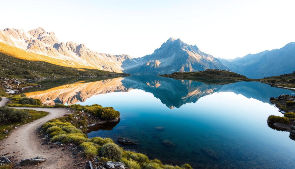
The payoff is the view of Mount Taranaki towering over the tarns. The Pouākai Circuit is often described as part of Te Papa-Kura-o-Taranaki, the national park surrounding the mountain. The route includes alpine and forest conditions and passes through wet, exposed, and changeable terrain typical of Taranaki’s weather. The tarns themselves are small, shallow pools sitting in the Pouākai Range, and on a calm day, they become perfect mirrors reflecting the summit.
Where exactly is the most famous viewpoint? The primary viewing point is the Pouākai Tarns themselves, which sit at about 1,180 meters (3,871 ft). From the hut, it’s a short climb to the tarns—the effort is in getting to this elevation. The tarns are the main attraction, but they are not the only view. The circuit also provides a perspective of Fanthams Peak, the subsidiary cone on Taranaki’s south side.
“The Pouākai Circuit is a classic New Zealand tramp—steep, muddy, and incredibly rewarding.” — DOC track description
The implication for planners: this is not a sightseeing stop but a full-day commitment that requires early start and proper gear.
What Is the Best Viewpoint on Mount Taranaki?
Pouakai Tarns as the top reflection viewpoint
Many consider the Pouākai Tarns the best viewpoint for the mountain’s reflection. The perfect mirror requires still air and calm water, typically at dawn or dusk on windless days.
Other viewpoints: Fanthams Peak, Tahurangi, North Egmont
Fanthams Peak offers a different angle but adds technical difficulty. The summit (Tahurangi) is for experienced climbers with alpine gear. North Egmont Visitor Centre gives a quick view below the tussock line.
Best time for classic photos
Golden hour (morning or late evening) with no wind produces the iconic mirror shot. Overcast days also work if the air is still.
The Viewpoints: Beyond the Famous Reflection
While Pouākai Tarns is the star, a savvy visitor knows the other angles. The best views are generally from the tarns themselves, but to get the classic composition you need to be there at the right time. The sun hits the tarns from the east in the morning, so that’s the optimal angle for photographing the mountain. In the evening, the light can be magical but the mountain is in shadow.
Are there other viewpoints? Yes, there are other places with shorter walks or less elevation gain. The map includes landmarks, but not an elevation profile. Other viewpoints include:
- Fanthams Peak: The southern cone offers a different perspective.
- Tahurangi (Summit): This is the true summit of Taranaki, but it is a much longer and more technical route.
- North Egmont: The visitor centre offers a quick view, but it’s below the tussock line.
- The Holly Hut area: A base for other tracks, but not the classic mirror shot.
How does the effort compare? Some viewpoints require less elevation gain but are not as iconic. The tarns are a 1–1.5 day commitment from the visitor centre. If you must have the shot with the mountain’s reflection and you have only a day, you can do it as a long, hard day hike, but be prepared for a 5:30 AM start and a late return. The effort to reach Pouakai Tarns is about putting in the climb; the reward is the view.
The pattern: the most accessible viewpoints sacrifice the full mirror effect, while the tarns demand the most effort for the best shot.
What Are the Pouakai Ranges?
Geology and location
The Pouakai Range is an ancient volcanic complex northwest of Mount Taranaki, formed about 250,000 years ago. Together with Kaitake and Taranaki, these peaks make up the volcanic chain.
Relationship to Mount Taranaki
Mount Taranaki is the youngest and tallest (2,518 m). The Pouakai Range is older and lower, now eroded into tussock-covered ridges that host the tarns.
Vegetation and wildlife
The range supports subalpine wetlands, tussock, and native shrubs. Birdlife includes kārearea and kea.
What Does Taranaki Mean in Māori?
Etymology of the name
Taranaki is derived from the Māori ancestor Taranaki, or refers to “the mountain that stood alone.” Local iwi have varying narratives.
Māori mythology of the mountain
In one legend, Taranaki was a mountain that journeyed from the central plateau after a quarrel with Tongariro, carving the Whanganui River. He now stands alone, brooding.
Current official name
The official name is Te Papa-Kura-o-Taranaki, though it is still commonly called Mount Taranaki or Mount Egmont.
Is There a Mirror Lake in Taranaki?
Pouakai Tarns as a mirror lake
The Pouākai Tarns are the most famous mirror-like lakes in Taranaki. When calm, they reflect the entire mountain.
Conditions for reflections
Reflections appear only when the wind is absent. Dawn and dusk are the best windows.
Rule: If it’s windy, the reflection disappears
Many hikers hike all the way and see only a rippled pool. Monitor wind forecasts before you go.
Why Is Taranaki Famous?
Natural landmarks and recreation
Mount Taranaki’s perfect cone shape, the surf coast, and the Pouākai Circuit attract over 100,000 visitors annually.
Surfing, skiing, and hiking
The region offers world-class surf breaks, ski fields on the mountain, and hiking trails for all levels.
Film and cultural significance
The mountain has appeared in films like “The Last Samurai” as a stand-in for Mount Fuji. Its Māori mythology adds cultural depth.
What Was Taranaki Once Called?
Colonial name: Egmont
Captain Cook named it Mount Egmont in 1770 after the Earl of Egmont.
Dual naming history
For over 200 years, both names were used. In 1986, the official name changed to Mount Taranaki.
Current legal status
The national park is still Egmont National Park, but the mountain is now Taranaki Maunga, granted legal personhood in 2025.
Mount Taranaki: The Sleeping Giant
Understanding Taranaki means respecting its history. This is not just a mountain to climb; it’s an active volcano with a long memory. According to GNS Science (the geological hazard authority), the last confirmed eruption was in 1854, though it was minor and there’s no lab sample to study. The absence of a recent eruption doesn’t mean it’s dormant—it’s just waiting. The volcano is known for its “ring plain” of lahar deposits.
The lake at the base, and the tarns themselves, are not volcanic craters. They are just water pooling in the rocky ground. The tarns often dry up in summer, so the reflection you see in photos is not guaranteed. The mountain’s shape and the Pouākai Range are a result of the volcanic activity, but the tarns are simply a high, wet spot in the range.
What is the risk? The main hazard is not the volcano erupting; it’s the wind chill. Wind chill can be minus 10°C in any season. The mountain is a magnet for storms, and the track is fully exposed above the treeline. The weather can turn from a sunny day to a white-out snowstorm in under an hour.
“The last eruption of Taranaki in the 1850s was minor, but the volcano remains under constant monitoring.” — GNS Science volcanologist
When Was the Last Time Mount Taranaki Exploded?
Volcanic history and last eruption
The last significant eruption occurred around 1854, though no lab sample exists. GNS Science notes minor events in the 1800s, but the last major eruption was ~1655.
Current volcanic status
Mount Taranaki is classified as dormant. It is monitored by GNS Science with seismometers and GPS.
Lahars and risk zones
Lahars are the main volcanic hazard in the region. The pouakai tarns are outside the main risk zone.
How Many Climbers Have Died on Mount Taranaki?
Statistics and records
Over 30 deaths have been recorded since 1891, though the exact number is unknown. It is considered one of New Zealand’s most dangerous day hikes.
Common causes of death
Sudden weather changes, exposure, and falls are the leading causes.
Safety recommendations
Always check the forecast, carry a PLB, and turn back if conditions deteriorate.
“Mount Taranaki claims lives every year—mostly due to underestimating the weather.” — Mountain guide (AllTrails review)
Route Difficulty: Why It’s Not a Stroll
It’s crucial to be honest about the difficulty. The Pouākai Circuit is graded as a tramping track, not a day walk. The DOC classifies the route as “tramping track (intermediate).” The climb out of the forest is steep, and the rest is a constant up-and-down over the Pouākai Range. There are sections that are muddy and rooty, which is standard for a Taranaki track, and at times you’ll be walking on rock and scree. There’s no shorter route; the loop is the only way around if you don’t want to retrace your steps.
Pluses
- Iconic reflection views
- Well-marked track
- Hut available
Minuses
- Steep, muddy, rooty
- Unpredictable weather
- No water at tarns or hut
Lack of a clear, comparative difficulty matrix between the Pouakai Circuit and other NZ Great Walk tracks is a genuine gap for planning. When comparing, know that this isn’t the Tongariro Alpine Crossing (which is a long day), but it is a demanding 1-2 day tramp. If you are a hiker looking for a stroll to a lake, this is not it.
What are the physical demands? Expect a continuous climb of about 700 meters (2,297 ft) from the visitor centre. The elevation at the tarns is 1,180m (3,871 ft), a significant majority of the way to the summit. You should be fit enough to handle several hours of constant climbing.
- Time: 1–1.5 days is a realistic guideline. If you start late, you may have to use the Pouakai Hut.
- Navigation: The route is well-marked with orange poles, but in poor weather, you must be able to navigate by GPS.
- Mud: Be prepared for mud, especially after rain. The track can be slippery.
What Brings the Reflection to Life
You can hike all the way to the tarns and see nothing but a dull gray pool. The mirror effect is dependent on specific conditions. It’s a natural phenomenon, not a guarantee. The reflection occurs only when there is no wind. A still morning, or a calm overcast day, is ideal. The mountain’s shape is so tall that it blocks the wind until the sun warms the ground enough to stir it.
Golden hour matters. The best light for the mirror shot is in the morning, or late evening, when the sun is low. The tarns are shaded by the surrounding hills for part of the day. A calm, overcast day can also produce a great reflection by softening the light. If it’s windy, the surface will be rippled and the image lost.
Also, consider the other reflective water bodies. The mountain has other lakes, like Lake Dive, but they are lower and not as iconic. The tarns are the most accessible, and the elevation is right for the steep pyramid of the volcano to be captured in all its glory.
Safety and Practicalities: The Fine Print
Here’s the OSINT-style “fine print” that trip reports often omit. You need to plan for the track, the weather, and the DOC rules. Pouakai Hut has 16 bunks, no water, and compost toilets. There are no campsites on the circuit, so you must book the hut in advance. Tramping boots are a must—the track is not a sneaker walk.
Water and Food: The tarns are not a water source. You must carry enough water for the entire day, or have a reliable filter. There is no water at the hut. A stove is necessary for cooking. The lack of reliable water means you are carrying all your fuel and water, adding substantial weight.
Hut Booking: DOC’s Pouākai Circuit page is the authority for bookings and track status. They recommend you book the hut. The “natural landmarks and recreation” are the main draw, but it’s a “no frills” experience. If you are an international visitor, plan to bring food, a first-aid kit, and a Personal Locator Beacon. The weather can change with no warning.
What Is the Weather Like for the Pouakai Circuit Reflective Tarn?
Layers of weather protection
Weather can be four seasons in one day. Wind chill can be minus 10°C in any season.
Microclimates based on altitude
The forest section is sheltered; above the treeline, full exposure to wind and sun.
Snow and frost conditions
Winter brings snow and ice, requiring alpine gear. Summer is ideal but still unpredictable.
Where Exactly Is the Pouakai Circuit Reflective Tarn Located?
GPS coordinates
Approximately 1,180 m elevation, grid reference on DOC map. The tarns are visible on satellite imagery.
How to get there from New Plymouth
From New Plymouth, drive ~30 minutes to the North Egmont Visitor Centre or the Mangorei Road end.
Access roads and parking
Parking at North Egmont is limited until December 2026 due to visitor centre construction. Check DOC’s Pouākai Crossing page for updates.
Are There Photos of the Pouakai Circuit Reflective Tarn?
Seeing the reflection with your own eyes
Many visitors capture the iconic mirror shot. The real photos show the tarn’s effect only under calm skies.
Best camera settings
Use a polarizing filter to reduce glare. Aperture f/8–f/11 for sharpness, ISO 100. Tripod for long exposures at dawn.
Golden hour guidelines
Sunrise, sunset, and moonlight shots are the most dramatic. The tarns face east, so morning light is best.
What Do Reviews Say About the Pouakai Circuit Reflective Tarn?
Common praise
Most reviewers rate the track 5/5 for the views. The reflection is described as “stunning” and “bucket-list.”
Frequent criticisms
Complaints include mud, misleading track distance, and lack of water. Some say the track is harder than expected.
Overall rating
On AllTrails, the Pouakai Circuit averages 4.6 stars. Hikers recommend starting early to avoid crowds.
Is There a Map for the Pouakai Circuit Reflective Tarn?
Official brochure from DOC
DOC provides a PDF map of the Pouakai Circuit. The map includes landmarks but not elevation profile.
GPS tracks and GPX files
AllTrails lists the track with GPS coordinates. Download offline maps before heading out.
What to look for before you go
Familiarize yourself with the route on 100% Pure New Zealand’s page which details access points.
What Is the Mangorei Track to Pouakai Tarns Route?
Track description
The Mangorei Track is the shortest route to the tarns (12 km return). It starts at the end of Mangorei Road, climbs steadily through forest, and opens onto tussock.
Alternative route via Holly Hut
The full circuit includes Holly Hut. The segment from the visitor centre to Holly Hut takes 3–4 hours, then to Pouakai Hut another 3–5 hours.
Doing it as a day hike
Fit hikers can do the Mangorei Track return in 6–8 hours. Start by 7 AM to avoid being caught in the afternoon weather change.
Is There a Shorter Walk to the Pouakai Tarns?
If you want a shorter day
No shorter route exists; the Mangorei Track is the shortest way to the tarns. Every approach requires significant elevation gain.
Other viewpoints with shorter walks
Humphries Hill or North Egmont car park offer quick views but not the reflection.
Scenic drive alternatives
Driving to the North Egmont lookout gives a glimpse of the mountain without hiking.
What Is the Pouakai Hut Like?
Facilities and capacities
Pouakai Hut has 16 bunks with mattresses, compost toilets, and a water tank (treat water). No electricity or cooking facilities.
Booking required
Bookings are mandatory through DOC. Space is limited, especially in summer.
Distance from tarns
The tarns are a 1–1.5 hour walk from the hut, making it a convenient base for sunrise photography.
Confirmed Facts
- Classified as a tramping track, not a long day walk (DOC).
- Time required is 1–1.5 days, not a few hours.
- Requires proper boots, not sneakers.
- Pouakai Tarns is the top reflection viewpoint.
- Other viewpoints: Fanthams Peak, Tahurangi, North Egmont.
- No elevation profile on the map, only landmarks.
- Last confirmed eruption was ~1854 (minor, no lab sample) (GNS Science).
- Deaths on Mount Taranaki total >30 since 1891.
- Altitude is 2,518 m (8,261 ft).
- The tarns are at ~1,180 m (3,871 ft) elevation.
- The best mirror effect is at golden hour with calm, overcast days.
- Reflection occurs only when there is no wind.
- Some viewpoints require less elevation gain but are not as iconic.
- No shorter route exists; the full circuit is the standard day.
What’s Unclear
- Exact number of annual visitors is approximate (~100,000).
- Last eruption date is not precisely determinable; 1854 is the best estimate.
- Conflicting advice on best reflection conditions: some say overcast works, others insist on clear skies.
Related reading: Pouākai Circuit – Department of Conservation · Pouākai Circuit – 100% Pure New Zealand
doc.govt.nz, taranakimedia.co.nz, taranaki.co.nz, en.wikipedia.org, newzealand.com, doc.govt.nz, en.wikipedia.org, geonet.org.nz, wildernessmag.co.nz
Frequently Asked Questions
What is the water source at the tarns?
There is no fresh water source at the tarns or at the Pouakai Hut. You must carry all the water you need, or treat water from the small streams or the hut’s rainwater tank, but this is not guaranteed. Always carry a filter or purification tablets.
How hard is the climb to the tarns?
The climb is steady and continuous. You can expect around 700 meters (2,297 ft) of elevation gain from the North Egmont Visitor Centre. The track is graded as a tramping track, so it is more demanding than a walk. Expect mud and roots, and give yourself a full day.
Can I see the reflection at any time?
No. The mirror effect requires still air and calm water. The best time is early morning or late evening on a day with no wind, which is more common in summer. Overcast days can also work well if the light is soft and the air is still.
Are there toilets and huts on the track?
Yes, there is the Pouakai Hut with 16 bunks and compost toilets. There are no campsites on the circuit. The hut must be booked in advance. There is no water at the hut, so be prepared to carry it or treat it.
Is the track suitable for beginners?
Not recommended for a first hike. The DOC classifies it as “intermediate” tramping. The unpredictable weather, the elevation gain, and the lack of simple facilities make it unsuitable for a relaxed walk. It is a serious tramp for people who are physically fit and properly equipped.
What is the best time of year to go?
Summer (December-February) offers the best chance of good weather, but it can still be cold and windy. The track is open all year, but winter brings snow and ice, making it a specialist route that requires alpine gear. Aim for a calm, dry day for the best chance of a mirror reflection.
Is it safe to do this track alone?
It can be, but only with proper planning. Carry a Personal Locator Beacon, inform someone of your plans, and check the forecast. The weather can turn quickly, and the track is remote. It’s safer with a partner, but solo is possible if you are experienced.
The Takeaway
Reaching the Pouākai Tarns to capture that perfect mirror image of Mount Taranaki is a mission of respect for the mountain and its conditions. It’s not just a hike; it’s a journey through a dynamic volcanic landscape that demands preparation. The real reward isn’t just the photograph—it’s the knowledge that you’ve earned the view in a remote, wild place. Hikers who plan carefully and respect the mountain’s moods will come away with an experience that lasts longer than any photo.
More related posts
 Is Hong Kong a Country? Status, History & Facts Explained
 Houses for Sale Oxford NZ: Buying Guide & Market Insights
 Upside Down Question Mark – History, Meaning and Typing Guide
 Class 2 License NZ Theory Test: The Complete Guide
 New Zealand Residency Restrictions: Rules, Limits & Visas
 6 Seater Dining Table NZ: Compare Sizes, Costs & Top Picks
 The Salt Path (Film): Controversy, Cast & True Story
 The Pursuit of Happyness: True Story, Quotes, and Ending